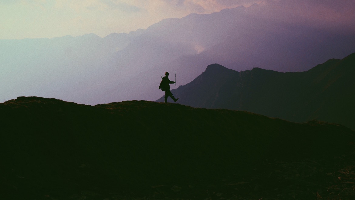


It’s been nearly 65 years since the first successful ascend of Everest, and the landscape of trekking has changed dramatically. What was once no man’s land, attainable only by hardcore mountaineers and rock climbers is now accessible to walkers; and nearly everyone can now roam across Nepal, India, Pakistan, Tibet and even Burma.
When visiting Nepal—home to Everest Base Camp—the Himalayas are undoubtedly one of the main attractions with its endless array of phenomenal treks, suitable for all levels of hikers. Here, you can venture high above the rest of the world, even to lands and panoramas seldom seen. For most trekkers, Everest Base Camp or Annapurna Circuit are the cream of the crop. Both are challenging, beautiful and full of rewards, however, Annapurna takes the cake due to its abundance of natural beauty and dizzying diversity of landscapes. The Apple Pie Trek, as it’s commonly referred to—due to the many tea houses that sell apple pies to hungry foreigners along the way—is the hike of a lifetime, brimming with quixotic landscapes seen only in dreams.
(Evan Ceretti)
Routes and environmental and social impact
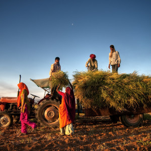
Despite Everest being the tallest mountain in the world and a name that strikes awe when mentioned, Annapurna might be Nepal’s most popular hike. Opened to foreigners in 1977, the circuit crosses two river valleys and encircles the Annapurna Massif (Annapurna I-IV) as well as roughly 30 other peaks between 19,685 and 26,247 feet high. Of the 140,000 people that head to Nepal to hike every year, a little more than half trek in the Annapurna region, and those numbers are growing. Due to its popularity, the circuit has seen an increasing amount of construction, which has had profound affects on the local people, the environment, the trekkers, and the circuit itself.
This economic expansion is sometimes beneficial to secluded villages on the circuit, which become more accessible with new roads. However, hikers can opt to bypass many villages—which would have typically been part of the circuit—and hop on a bus to save time. This has caused an increase in construction, buses, and 4×4 vehicles, which in turn creates more garbage; ultimately polluting the clean, formerly untainted Himalayan air. Indeed, ‘progress’ has changed the once remote trek into something less attractive, however, there are many new routes that remove you from moving vehicles, up into the less-trampled foothills where the only thing running is fresh water.
(Caitlin Wynne)
Getting there
Preparing for and getting to the circuit are both relatively easy. The circuit length varies between 100 and 143 miles, depending on where you start and finish the hike, as you can easily take a bus deeper into the mountain range before actually getting on your feet. Most trekkers start and finish in Pokhara. Basically all hikers tackle the circuit in an anti-clockwise fashion, because the daily altitude gain is slower and more spread out.
The track begins in Besisahar, a 4-5 hour bus drive from Pokhara, but many hikers take the bus to towns further along the track, typically to Ngadi or Jagat, some 16 miles deeper. Today, you can take transportation all the way to Manang, 56 miles from the starting point. What used to take 15-20 days can now be drastically shortened, but ultimately the duration of the trek depends on details like side trips, rest days, fitness levels, weather, start and finish points, and acclimatization. It took me 14 days with one day for rest. Many people stop in Jomsom or Tatopani (where I finished) and take a bumpy and dreadful bus back to Pokhara.
(Christopher Burns)
Best times to visit
The two best times to visit are after monsoon season in October, and before monsoon season in March and April, when the climate is pleasant and beautiful rhododendrons are in full bloom. The trek starts on the muddy roadside, soon passing paddy fields, waterfalls, subtropical forests and giant cliffs. Scenery changes around every mountain bend, and as you ascend and descend in and out of different climatic zones. As the altitude gets higher and higher, the sun relentlessly shines down with ferocious power and cheeks quickly become sun-kissed. The faces of elderly men and women look as if they’ve always been in the sun: leathery, weathered, and have seen many days. The sun’s glare off the snow is almost blinding and makes things difficult to see, so remember to bring a pair of UV protection glasses.
Be prepared
The weather changes quickly, so pack for it. Don’t skimp out on appropriate gear, because when it rains, snows, and blows from all directions you’ll be thankful to have proper necessities. Bring thermal clothing, extra socks, hiking poles, all-weather hiking boots, a heavy coat, gloves, a hat, and winter clothes. All hikers require a $20 permit, and a $20 TIMS Trekkers’ Information Management System card, which is to be presented at checkpoints along the way. Plastic pollution is a big problem in these larger-than-life mountains: bring out what you bring in. Consider taking iodine tablets, and refilling your bottle at water refill stations that are all along the route.
Guide or no guide?
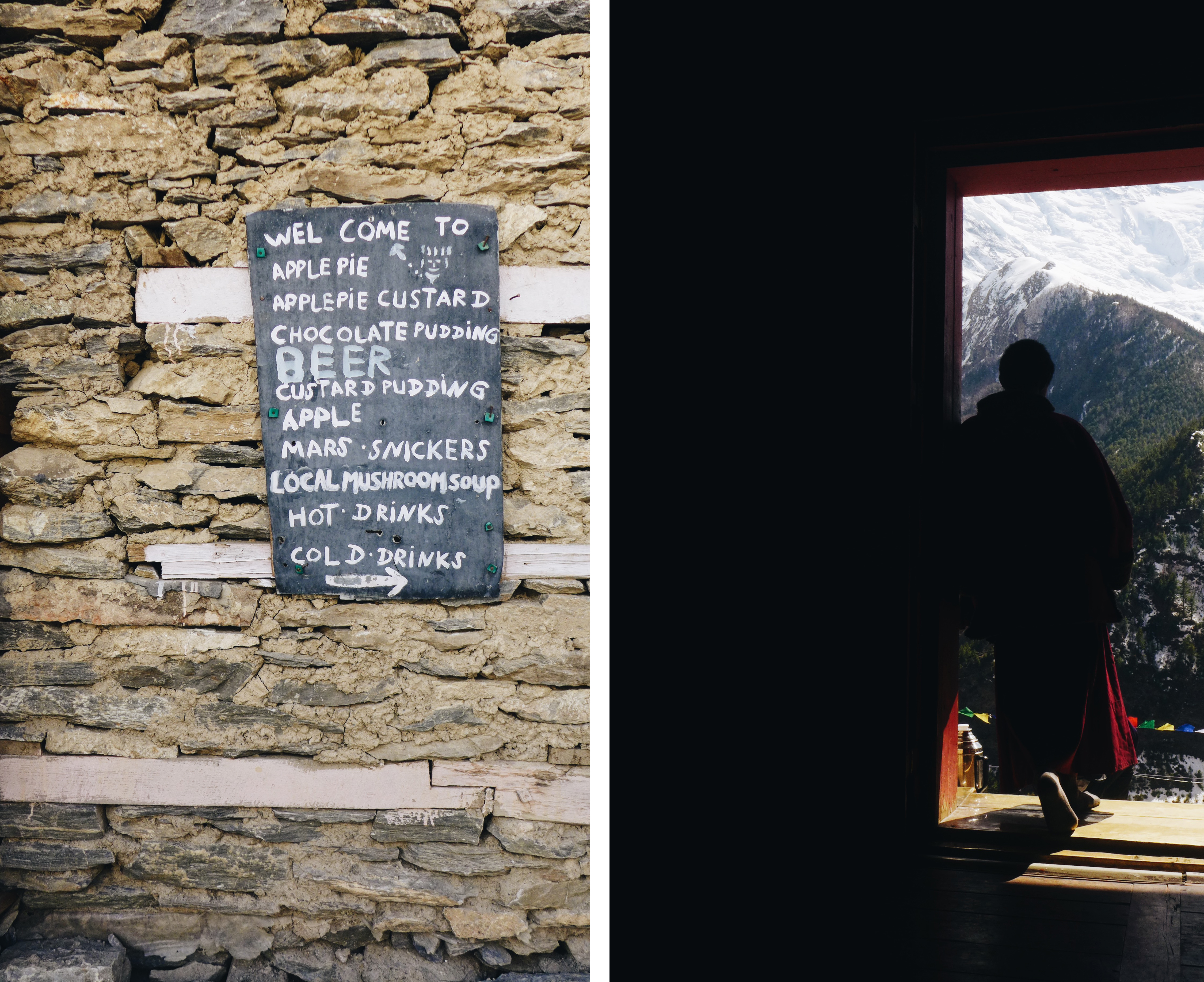
Some trekkers choose to take a guide. I didn’t do this, and I didn’t see many individual trekkers who did. However, it might be the right option for you. If you’re trekking in high season, there will undoubtedly be hundreds of other trekkers on the same paths. I teamed up with others on the very first day. It’s important to hike with people who keep a similar pace. Most commonly, trekkers hike between 6-12 miles each day, more or less depending on the terrain. Tea houses and ‘hotels’ are found in every village throughout the horseshoe-shaped circuit. Arrive early to beat the crowds and to ensure a place to sleep.
(Martin Jernberg)
Accommodations
During the hike it became apparent that many accommodations were desperate for people to stay, so much so that they were willing to make next to nothing. The rule of thumb on the hike is that you would sleep for free if you bought lunch (or dinner) and breakfast. This is often abused. Bargaining is surely a way of life, but don’t overdo it. I didn’t often need to haggle, and found myself staying comfortably for $3-5, including lunch. It’s a shameful thing to watch well-off travelers haggle over cents—literally—with a desperate family in an often desolate area of the world. (Note: for those of you that wish to stay connected, the busier towns all have wifi.)
Eat + Drink
Meals are simple but delicious. Dal Bhat is ubiquitous and hopefully you’ll learn to love it, like I did. The dish consists of dal (lentil soup), bhat (rice), and probably some curried potatoes, and sautéed morning glory. Nutritious and delicious! Ginger lemon honey tea is a hot commodity, too, which will help you adjust to the altitude. Fill up on food, as you’ll need it when hiking 12 miles a day; and remember to pack high-energy snacks to keep you going between secluded villages.
(Sergey Pesterev)
What to expect
Though the circuit is relatively safe, a sudden blizzard in 2014 killed 43 people, half of whom were Nepalese. Acute mountain sickness (altitude sickness) is also a real danger if necessary precautions aren’t taken. I saw people who ascended too quickly and were feeling the repercussions, which can be fatal. Helicopters were airlifting unsuspecting victims from the area every other day. Make sure you have travel insurance with necessary coverage.
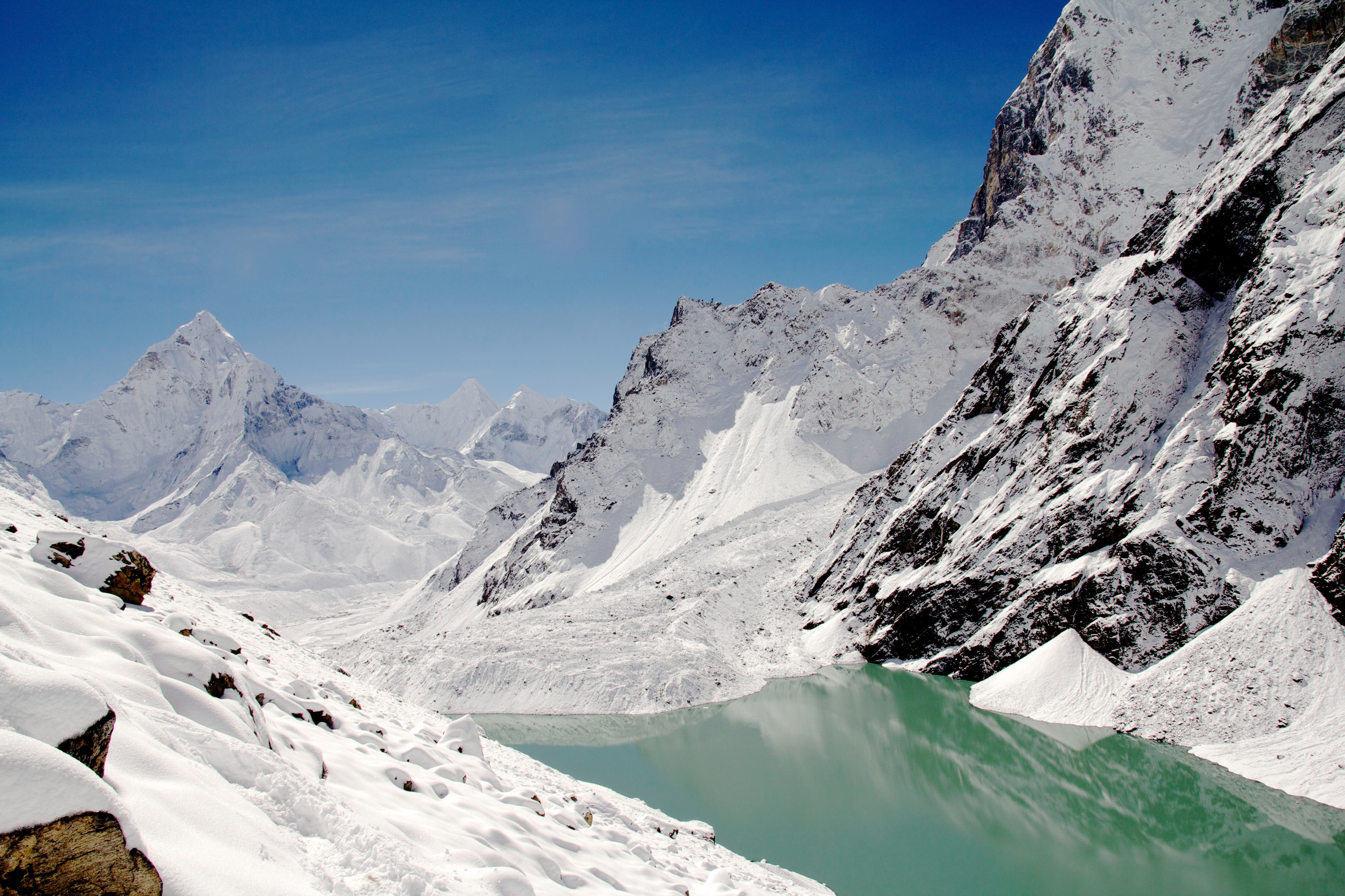
The hike from Besisahar can take 5-10 days to get to Thorong-La Pass, the highest point and most difficult leg of the trek. At 5416 meters, Thorong-La Pass takes your breath away. This hike is not for the impatient. Slowly, as I struggled to regain my breath and gasped for dry air, I would put one foot in front of the other and focus on reaching the top so I could start descending. The area was blanketed in heavy snow, which made it much more difficult. Descending a mountain might sound easier than going up, but it’s often not. Switchback after switchback after switchback is tough on rubbery legs, especially when on trampled, snow-covered, muddy paths. However, when you reach the bottom (the ‘bottom’), you’ll feel like a champ.
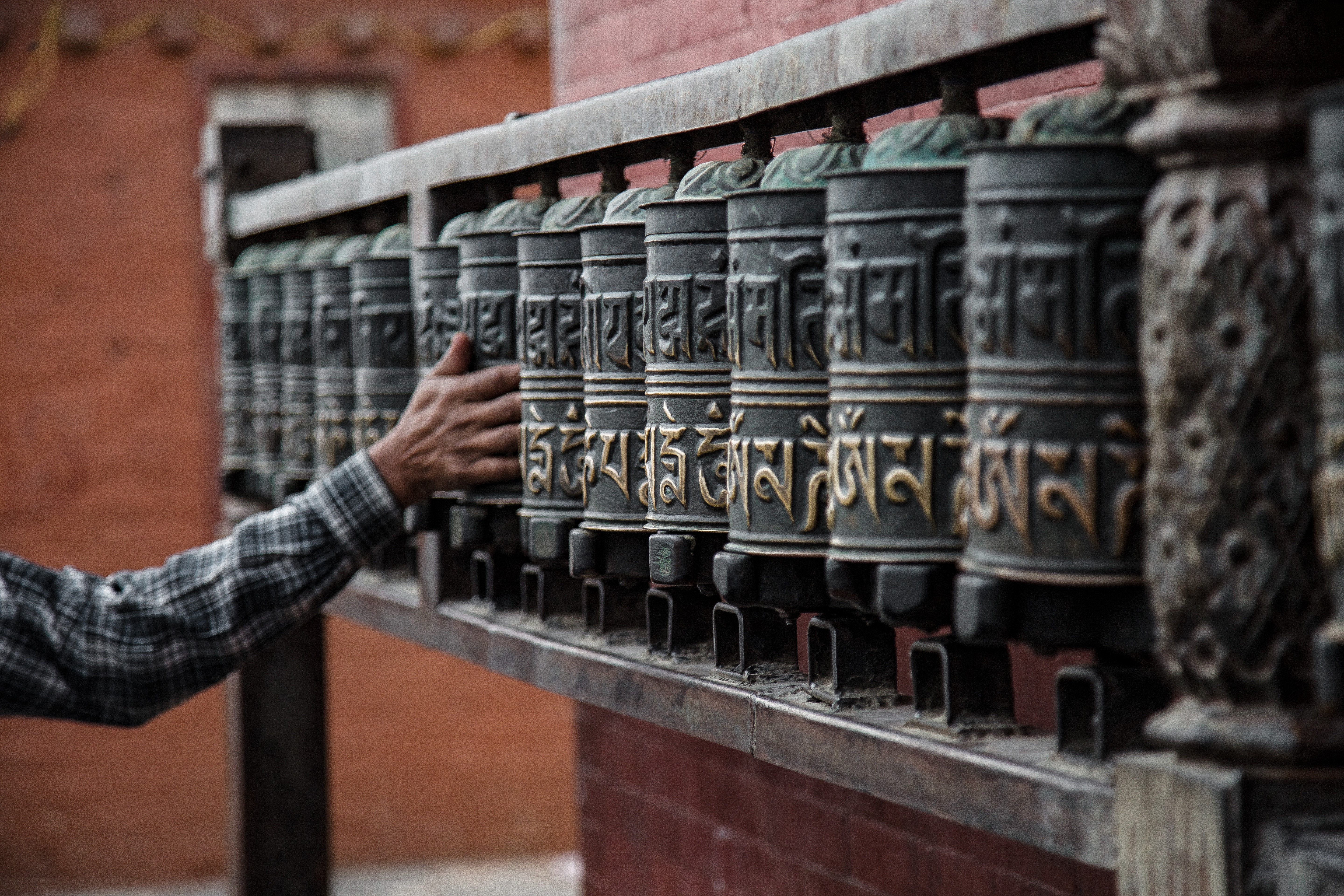
On the other side of Thronog-La Pass, the sounds and sights of nature became ever more apparent: raging rivers, rasping birds, fewer yak but more buffalo, and flora to be foraged. Things slowly become greener and greener as you leave the giant snow-capped peaks behind. Gorgeous pine forests appear out of nowhere, and more Thakali villages pop out of the the cliffside. The Lower Mustang region, which you can’t enter without a pricey permit, looks like out of this world—desolate, desert-like terrain, and dry, rock-layered riverbeds that have long been awaiting the monsoon. When night falls in Himalayas, the moonlight brightly cloaks the mountains, creating a stunningly monochrome scene. It’s one of the most beautiful landscapes I’ve ever witnessed and feels like the quietest place on earth.
(Martin Jernberg)
Don’t rush. I repeat, don’t rush. This area is breathtaking, almost unimaginably so. Unless you’re in a real race, people don’t want to hear how quickly you ‘did’ the circuit, and you’ll have no real stories to tell. While you might trek quicker than others, and while it’s often good to set a pace and stick to it, remember to pick your head up and look around. Everyday I saw people who only thought about numbers (how many minutes, hours, days it took to finish), and who had one mode: go. If nirvana exists, this is the closest you’re going to get to it on earth. While the air is thin, breathe it all in and appreciate the endless beauty of the Annapurna region.
Some days on the circuit are eerily quiet, but if you listen closely, avalanches can be heard in the distance—a reminder of just how powerful mother nature is in the world’s greatest mountain range. Life still thrives in even the most remote places—yaks forage on the mountainside, and giant vultures can be seen high in the sky above, looking for victims who have fallen to the elements.
(Evan Ceretti)
Ultimately, hiking the Annapurna Circuit was one of the most rewarding and gratifying experiences of my life. Despite being reasonably fit, at some points, I didn’t think I would be able to continue. I persisted, however, and I’m glad I did. I was rewarded with picturesque views of unique landscapes around every corner—jagged cliffs, carved-out valleys, well-preserved Tibetan-style villages clinging to mountain sides, fields of wild marijuana, snowy mountains towering in the air, pristine pine and oak and subtropical forests, boulder-layered rivers that have become dry before the monsoon, ancient deeply-carved canyons, all below brilliantly blue skies in the Himalayas. The hike allowed me to disconnect from world (in a healthy way), ditch technology for a while, and reconnect with nature in the one of the most naturally-rich areas of the world.
Feature image by Yatharth Roy Vibhakar.


Leave a reply